


Catalogue no. 1Asola, province of Mantua, ItalyPrototype
Same town,
different times.
Google Maps offers us the present from the sky and a view (jumpy) from the ground. I’m building the engine to capture the past and make it explorable: a free-roaming web world where a timeline reshapes the town, following real proof and data. Where there is none, it stays unfinished.
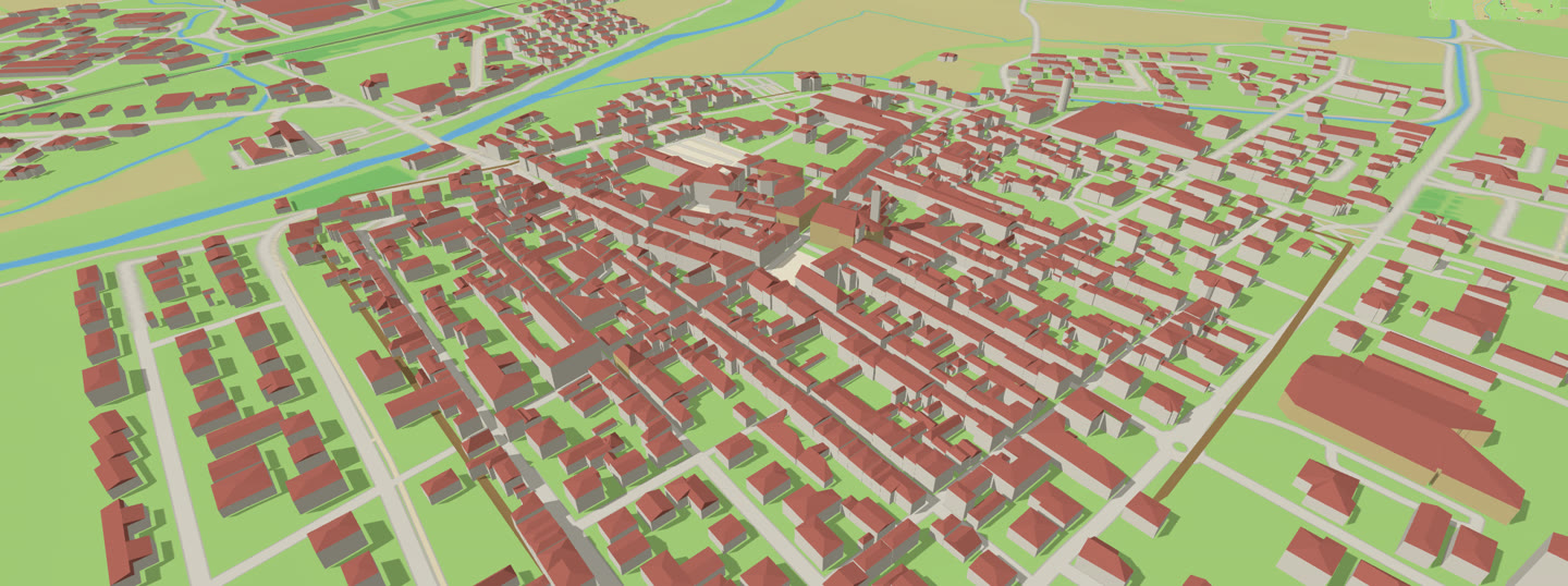
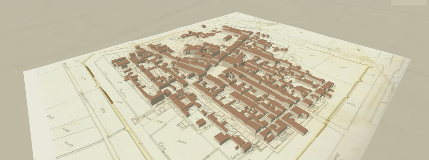
.jpeg) The same view, 1831 and today. Drag the handle.
The same view, 1831 and today. Drag the handle.
Left · 1831The land-register map of 1831, fitted onto today’s town with 7 points in common. The map on Wikimedia Commons, public domain ↗
Right · 20262,440 building outlines from OpenStreetMap ↗. 1,938 of them with a measured height and roof, from a laser survey flown in 2008 ↗.
The town today.
Why
Every generation
sees and lives a different town.
And yet it is the same town. The same old place that is still there, the ones that are gone, others forgotten. The goal is to put the years side by side and offer the chance to walk through them and relive them freely.
Only what a source proves is shown: a map, a survey, an old plan, a photograph. Where there is none, the town stays grey, on purpose.
The year, moved.
RecordedThirty seconds of the prototype: from today to 1831, the old map appears under the town, and each source shows up as the year reaches it.
The walk.
Human height · ExplorationWalking through the city, like in a videogame (WASD). Click a building and its card opens with historical and registered data. Being able to actually walk through and see Asola, documented, at different times.
How it is made
From public records and contributions
to a town to explore.
Eight steps, the same for any town with a map, a laser survey and an archive of old photographs. Asola is the first real test.
“Nothing invented. Everything cited.” the engine’s rule
-
01
The map
Every building outline and every street, from OpenStreetMap, at real size (1:1).
2,440 buildings · 1,094 streets · © OpenStreetMap contributors (ODbL, an open licence) ↗
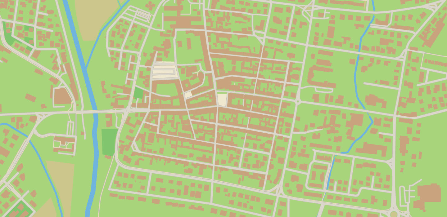
the map’s own lines, drawn by the engine -
02
The survey
In 2008 an airborne laser scanner measured the ground and every roof of the town at one-metre steps. From that the engine reads each building’s height and roof shape, reporting which ones it could not read.
1,938 heights and roofs · data of 20–21 November 2008 · the environment ministry’s laser survey (LiDAR, PST, CC BY 4.0) ↗ · the church on the map, no building tag ↗
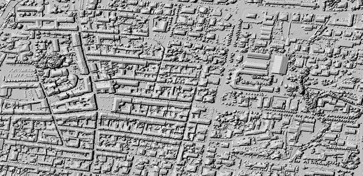
the surface as the laser measured it -
03
The past on paper
Old maps and views that carry a date, fitted onto today’s town with points in common. The land-register map of 1831 provided: walls, blocks, 469 buildings. The 1697 view has been found, not yet worked on.
7 matching points · the 1831 map, Wikimedia Commons (public domain) ↗ · the 1697 view ↗
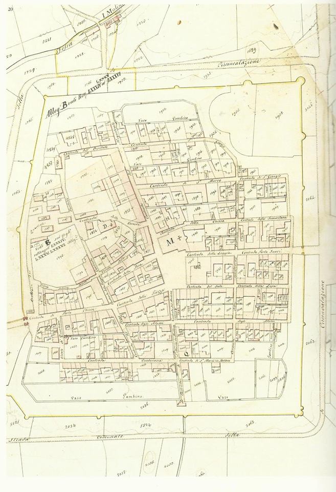
1831 map. -
04
The model
Buildings on real ground, in the browser and in a Blender file (3D software used in the project) from the same data. Each building lists its sources.
3,895 3D objects · 98,069 corner points · built from the steps above
the town, today -
05
The photographs
Photographs from the street, one building at a time. By recalculating where the camera stood, the engine can recreate the facade. People, number plates, signs and obstructions are removed with a meticulous method.
the first building: four photographs · Panoramax (CC BY-SA 4.0) ↗
the square in one of the photographs, all round: drag to look · wegavision, Panoramax, CC BY-SA 4.0 -
06
The years
Each source shows what was there, with a date. Move the year, and the source nearest in time draws the town. Where no source shows anything, the town stays grey.
two whole towns today: 1831 and 2026 · sourced.
the difference between years and sources, made visible. -
07
The walk
Two clicks, in the browser, nothing to install. While exploring, click a building and its card opens: sources, data and history.
the same prototype, street view
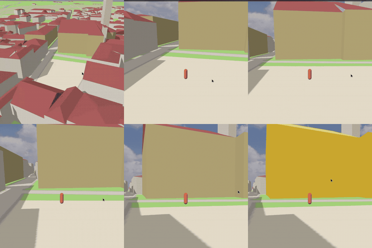
the walk, click on the church, its card -
08
Archive
Photographs nobody has scanned, the ones in archives or private collections. Each is an equal source: dated, credited, helping to create the town.
what no record holds · bring a photo ↓
How, in detail
The first building:
the town hall, done by hand.
One building, to learn the recipe: the town hall on the main square. Blocks and arcade come from the region’s building survey, ground and roofs from the laser survey + four street photographs that cover its walls.
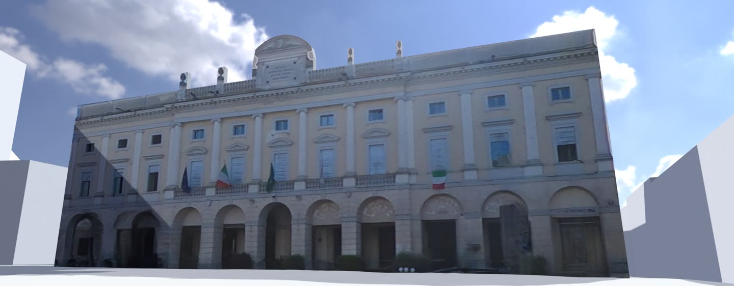
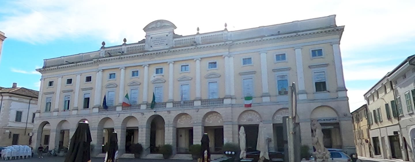
Our model against the photograph, one camera. Drag the handle.
The checkThe camera was worked out from the picture: the tilt from the building’s vertical lines, the direction and position from the roofline matched against the survey. So the model converges where the photograph was taken, and the two overlap. Where they differ, the model is wrong, and the overlay shows where.
Sourcesthe region’s building survey, DBGT (CC BY 4.0) ↗ · the 2008 laser survey, PST (CC BY 4.0) ↗ · photographs by wegavision, 2026-06-11: west ↗ · north ↗, Panoramax (CC BY-SA 4.0) · the camera’s place on Mapillary ↗ · these pictures CC BY-SA 4.0
How the camera was found, in five pictures
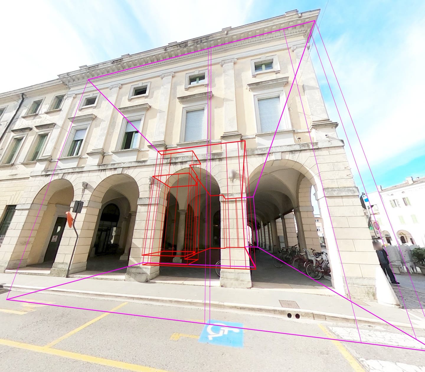
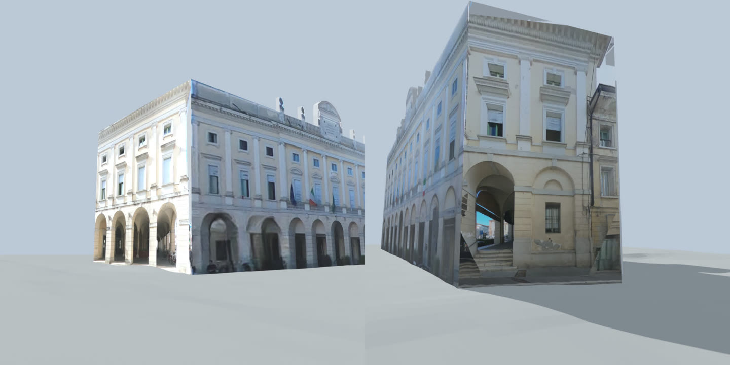
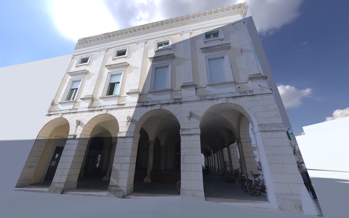
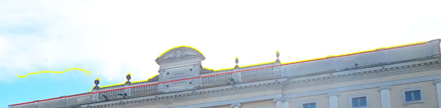
The square around it, the same way: every building on the main square from the region’s survey, with the street photographs on the surveyed walls.
photographs by wegavision, Panoramax (CC BY-SA 4.0) · DBGT Lombardia (CC BY 4.0) · PST LiDAR 2008 (CC BY 4.0) · the sky in f: Kloofendal 48d, Poly Haven (CC0) · these films CC BY-SA 4.0
When · today
Progress.
Some updates on the state of the project.
Who
Bring an old photo
of Asola.
Anyone can fill a gap in the record. The history of this town is in the lives of its people: a photograph with a year and a street is proof. If shared, it will be scanned, credited and given back, and the building will appear in the model at its year.
Building import, removing the rest: faces, people, plates, cars, the name on the doorbell. The original is not published.
Sharing a photo online is being worked on, but you can always contact me; Progress says when ↑
This whole project is currently carried forward by one person, and everything runs on what people feel they can share: a photograph from a drawer or a hand with the costs.
Support the creator: Ko-fi ↗
What to bring
- The photo
- Print, digital. Any condition.
- When
- A year, a decade, or a “period”.
- Where
- Asola & surroundings.
- Whose
- Your name, if you want it credited.